Written by Soudip
October 10th 2014

You Are Here
Home > America > Independence Hall Historical Facts and PicturesMonumental Earthworks of Poverty Point Historical Facts and Pictures
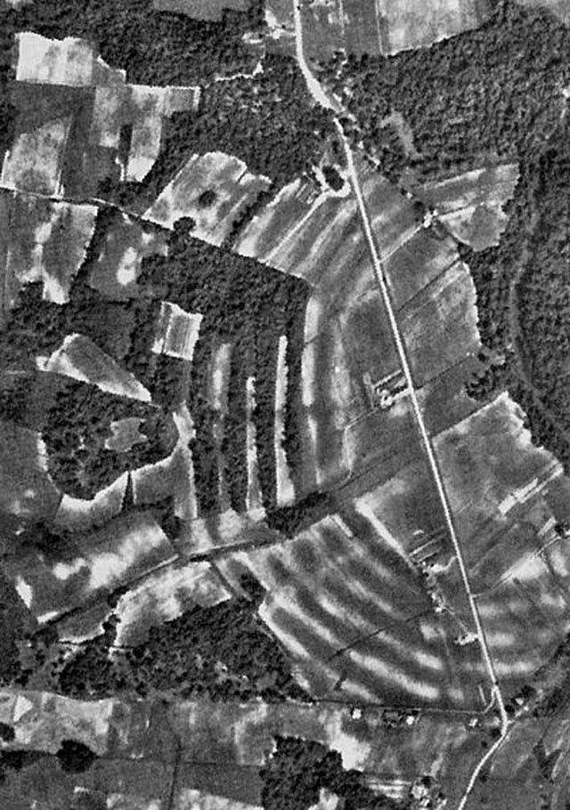
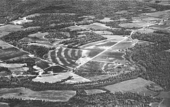
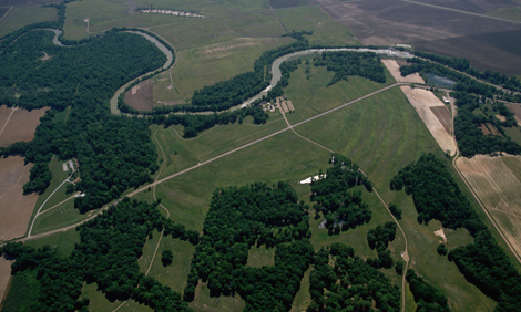
The prehistoric earthworks of Poverty Point culture are located in the Southern United States, 15.5 miles away from the Mississippi River. Considered as the largest, as well as the most complex earthwork occupation in North America, the site consists of 6 concentric curved ridges, several mounds and a central plaza, which were built between 1650 and 700 BCE, by a group of Native American people. Most of those people were hunter-gatherers.
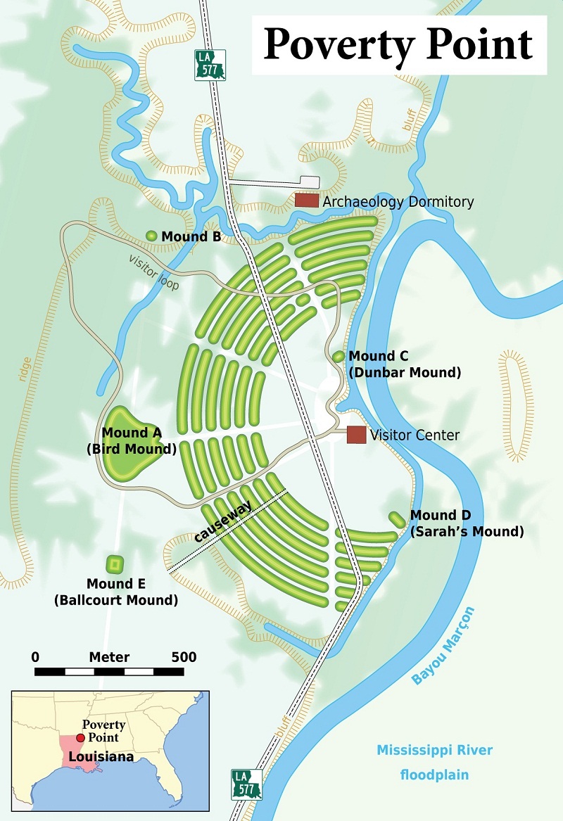
Monumental Earthworks of Poverty Point Map
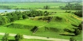
Monumental Earthworks of Poverty Point
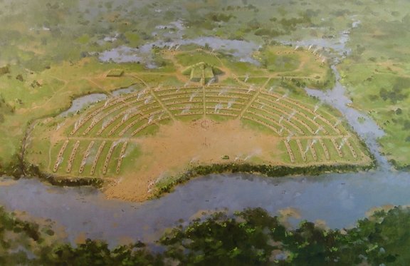
Monumental Earthworks of Poverty Point Ariel View
Monumental Earthworks of Poverty Point Images
Structural description of Poverty Point
Located at the center of Poverty Point, the 6 concentric earthworks are the main part of this site, which are divided into 3 sections by a flat passage of earth. All the ridges are 3 feet high. The T-shaped, Mound A is located on the west of the ridges. It is also called the Bird Mound for its resemblance to a bird. Mound B is located on the west and north side of the ridges. It is a platform mound, under which a human bone was found, which suggested the mound to have been a burial ground. The 6.5 feet tall, domed shape, Mound C is the only one resides within the plaza area. Comprising 2 shallow depressions on its flattened crest, Mound E, also called as Ballcourt Mound, resembles outdoor basketball playing areas. The Dunbar Mound consists of different types of precious stones. The oldest among all mounds, the Lower Jackson Mound is situated on the southern side of Poverty Point.
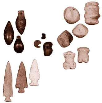
Artifacts of Poverty Point
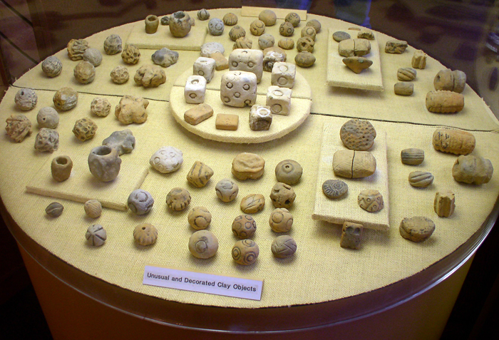
Clay Cooking Balls Found at the Poverty Point Site
Monumental Earthworks of Poverty Point Pictures
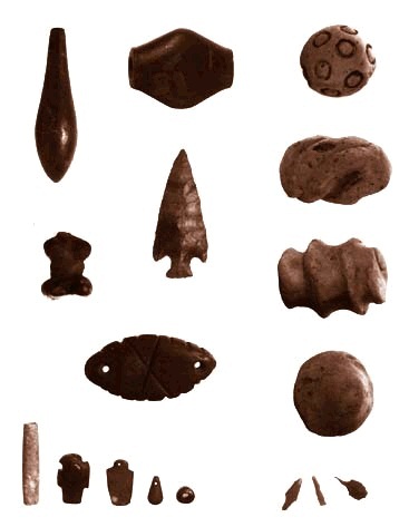
Poverty Point Artifacts
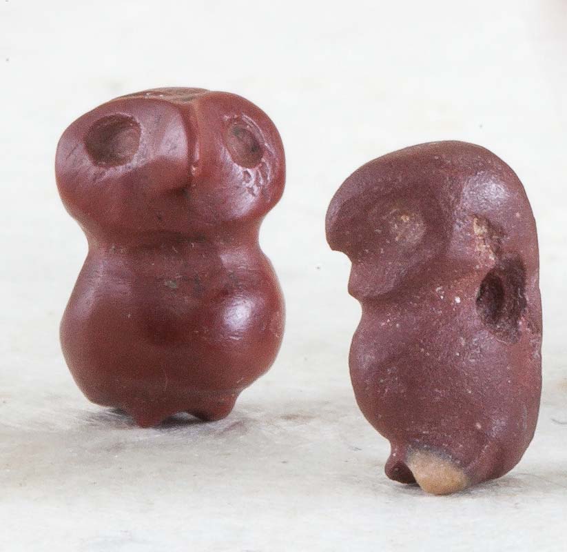
Poverty Point Owl
Archaeologists have suggested various possibilities to the purpose of this archaeological site that includes a trading center, a settlement and a religious complex. The name “Poverty Point” was derived from a nearby plantation. The site drew attention of the archaeologists in the early twentieth century and was briefly investigated by Clarence B. Moore, Gerard Fowke and Clarence H. Webb. Further excavations in 1952, 1953 and 1954 by Robert Neitzel and James A. Ford led to the publication of “Poverty Point, a Late Archaic Site in Louisiana” in 1956. Occupying 910 acres of land, this UNESCO World Heritage Site is now a popular tourist destination.